[New post] Hiking Pelister National Park: The Highest Peak & The Pelister Eyes
Ken Lawrence posted: "Created in 1948, Pelister is North Macedonia's oldest national park. Home to Baba Mountain and its eight peaks, the park was named after the very highest one, Pelister, which reaches up to about 2601 m. Other highlights of hiking Pelister National Park in"
Created in 1948, Pelister is North Macedonia's oldest national park. Home to Baba Mountain and its eight peaks, the park was named after the very highest one, Pelister, which reaches up to about 2601 m. Other highlights of hiking Pelister National Park include a trek to the Pelister Eyes, two scenic lakes not far from the village of Nizhepole.
Conveniently, Pelister National Park is very easy to reach. From Bitola, North Macedonia's second-largest city, one can simply hire a cab for about 250 MKD one-way. As such, visitors can easily spend the day hiking before returning to the city in time for dinner.
In the following guide, we'll be going over some of the popular day hikes one can experience at Pelister National Park. While the route I ended up taking was a little bit different, I managed to visit all of the park's highlights which you can see pictures of below.
Also, be sure to check the very end of the article for information on where to stay in Bitola and how to get there.
Hiking Pelister National Park: Essential Info
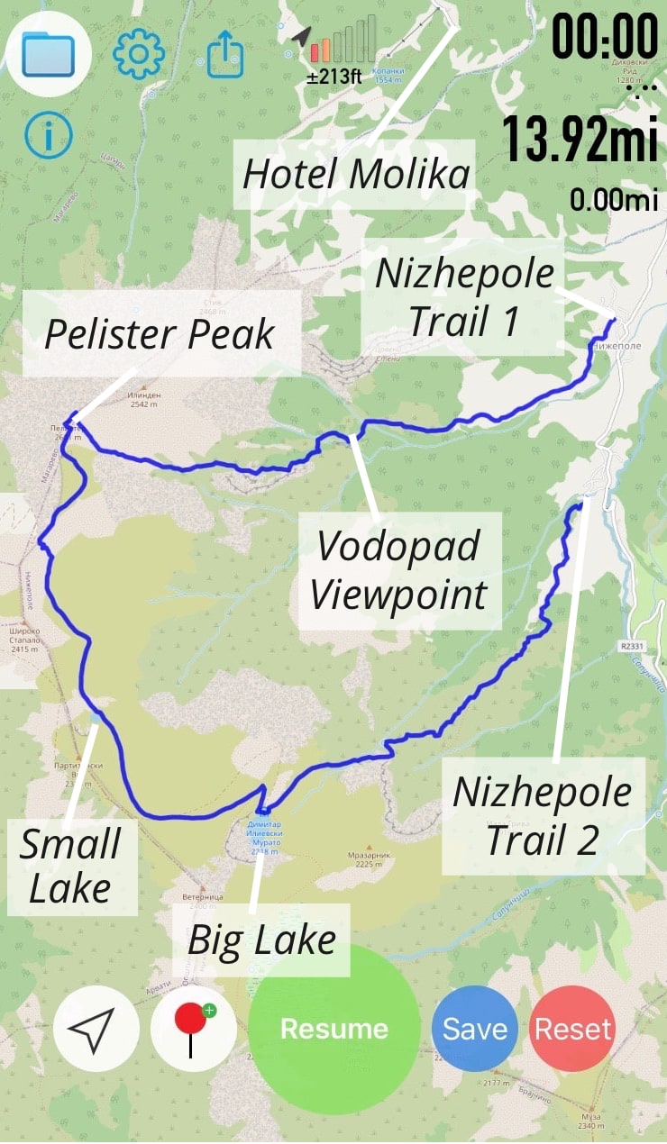
RECOMMENDED ROUTES: If don't have much time or are simply looking for a shorter hike with nice views, consider hiking up to the Vodopad viewpoint. There's a trail from Nizhepole (Trail 1 on the image below) that leads directly to the viewpoint which only takes about 70 minutes. You can then come down the same way and call a taxi to bring you back to Bitola.
The most popular day hike in Pelister National Park is the one to both lakes, known as the Pelister Eyes. This trek also starts from Nizhepole, but not from the same trail leading to the Vodopad viewpoint (Trail 2 on the image below).
It takes a little over three hours to reach the smaller lake from Nizhepole, and then you can walk back the way you came and return to Bitola by taxi.
For those wishing to visit the park's highest peak, Pelister, you can simply keep walking uphill another 70 minutes along the path past the small lake.
Once at the peak, rather than climb down the same way you came, you can continue northeast along a different trail. After around two hours of hiking, you'll reach a hotel called Molika, at which you should be able to have them call a cab for you.
The route from Nizhepole to the two lakes and then onto Pelister and Hotel Molika would take around 7-8 hours, taking rest time into account. This was the route my travel companion and I had planned to take, but things didn't quite turn out as planned.
As seen on the map below, there are two hiking trails from Nizhepole, and we mistakenly told the taxi driver to stop by the first one. This trail (Nizhepole Trail 1) leads to the Vodopad viewpoint and not the lakes.
Rather than turn back, we ended up hiking off-trail from the viewpoint all the way to Pelister peak. Then from the peak, we got back onto the trail to walk down to the lakes and ultimately back to Nizhepole via the other trail.
If you're hoping to visit the lakes as well as Pelister peak, I'd recommend just following the trail in the route mentioned above. But if you're interested in the route I took, I recorded a GPX route which you can download here. Only attempt this hike at your own risk.
RECOMMENDED APPS: Before the hike, be sure to download the Maps.me app, which contains very accurate trail outlines for Pelister National Park.
If you're interested in attempting the unusual hiking route I took, which will be described in further detail below, you can view this GPX file in Android apps like GPX Viewer or iPhone apps like Open GPX Tracker. (Please leave a comment if you're having trouble viewing it.)
WHAT TO BRING: If you're going to be making it up to Pelister peak, this is a rather difficult hike and decent hiking shoes are a must. If you have them, also bring trekking poles.
Fortunately, despite the elevation, there aren't many sections that are terribly steep going either up or down.
But as this can end up being a long hike, be sure to bring enough food to last you the entire day. Also be sure to bring a water bottle or two, but nothing so big to the point that it'll weigh you down. You'll encounter numerous springs throughout the park at which you can refill your bottle.
IS HIRING A GUIDE NECESSARY?: Many sources online, in addition to many locals, state that a guide is necessary for hiking Pelister National Park. But at €50 per day, they don't come cheap. But now having hiked through the park, I don't feel a guide is necessary.
While I'm not recommending everyone hike off-trail as I did, I can confirm that the trails between Nizhepole, the Pelister Eyes and Pelister peak are all well-marked. The clear trail markers combined with the technology of Maps.me means you should have little trouble navigating on your own (provided you get started on the correct trail!)
The route outlined below, but not necessarily the one you should take (see 'Recommended Routes' above)
From Nizhepole to the Viewpoint
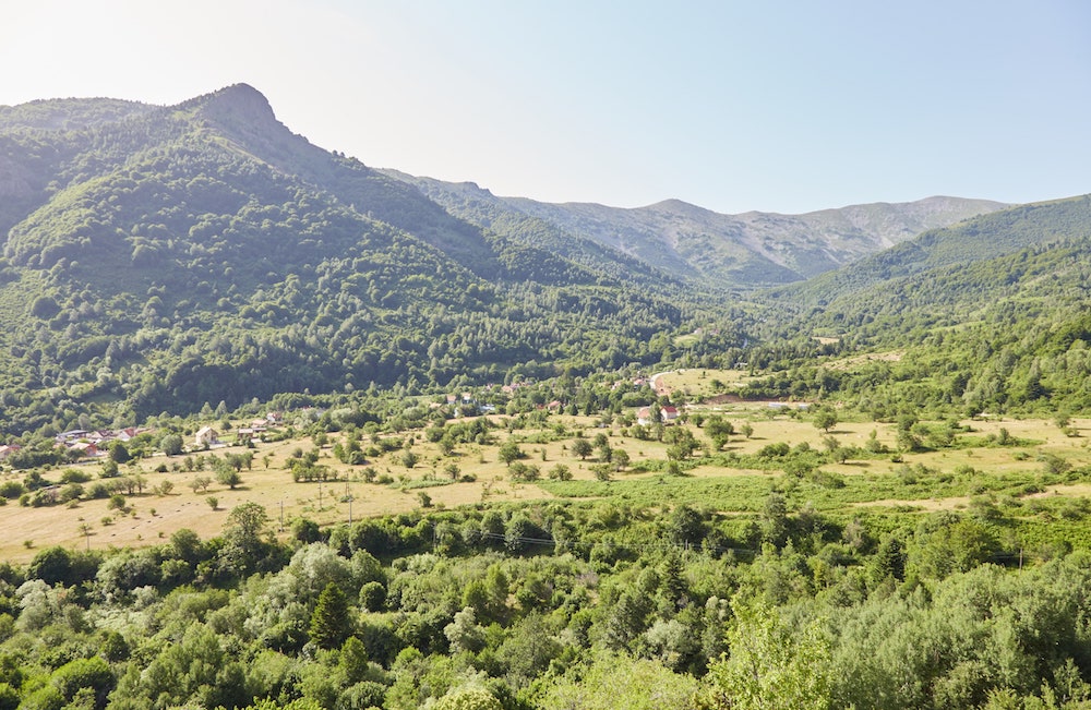
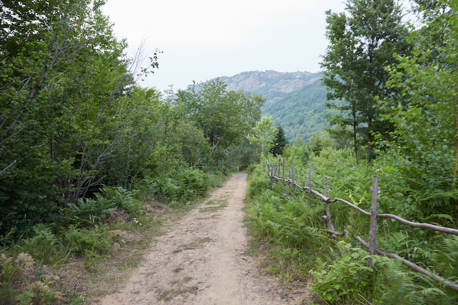
Most hikes in Pelister National Park begin in the village of Nizhepole. It's an easy taxi ride from central Bitola that only costs around 250 MKD (roughly $5).
There are two hiking trails from Nizhepole that are about a twenty-minute walk apart from each other. And people hiking to the lakes should tell the driver to stop at the second trail that's further away from Bitola.
Unfortunately, during my early morning taxi ride, I was zoomed too far in on the Maps.me app and mistakenly told our driver to drop us off by the first trail.
Nizhepole
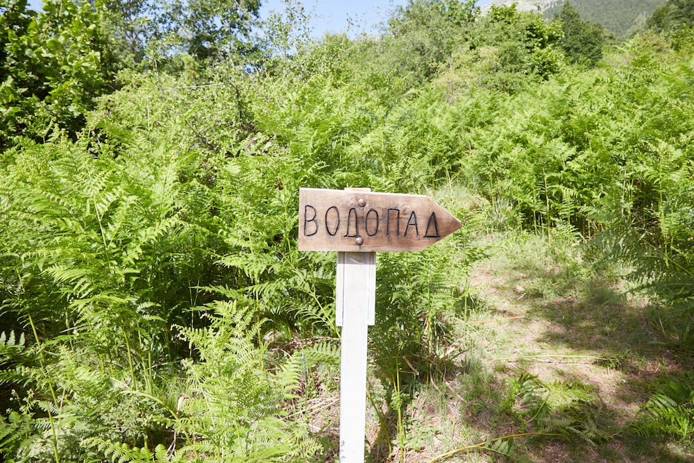
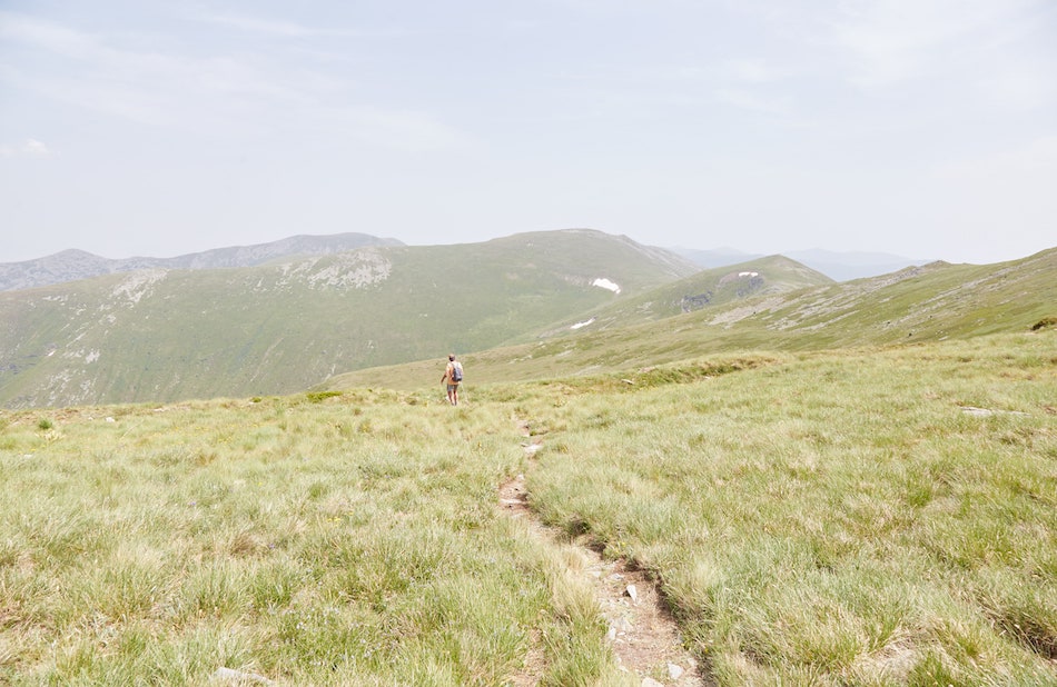
While our original plan was to start by hiking up to the lakes, also known as the Pelister Eyes, we found ourselves on a different path leading up to a viewpoint called 'Vodopad.'
I realized the mistake several minutes into the hike, and we still would've had plenty of time to walk back to the village and find the other trail. My hiking companion, however, insisted that we keep going. Even if the trail officially ends at the viewpoint, he said, we'd surely find a way up the mountain regardless.
I was a bit skeptical and wanted to stick with our original plan. But he had decades of trekking experience all over the world, and he assured me that hiking off-trail was no big deal. Moreover, he said he even prefers it.
And so we continued upward toward the Vodopad viewpoint. While the trail here was clear and easy to make out, it was densely overgrown with ferns and other plants that constantly scratched out legs.
I don't regret not wearing long trousers, however, as the temperature was supposed to reach the mid-30s C.
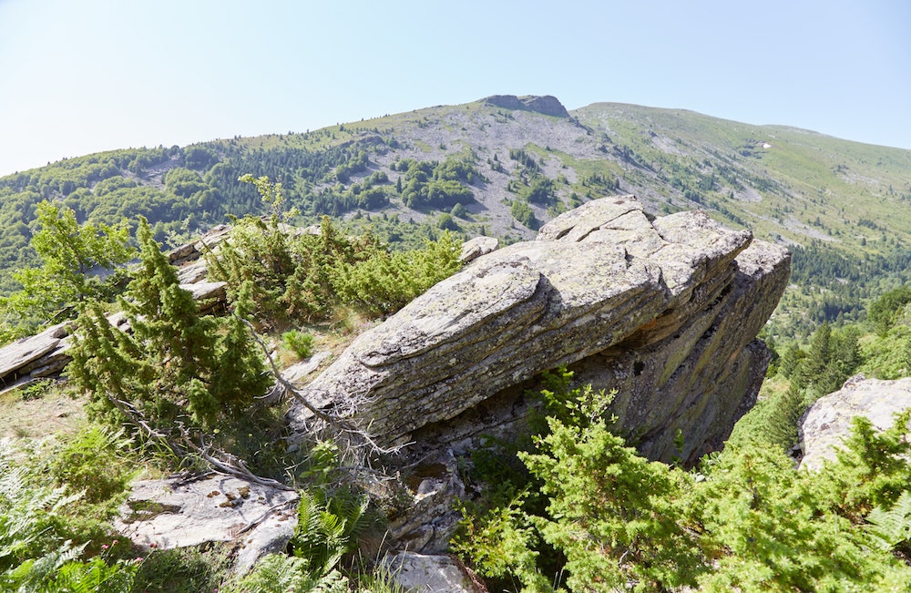
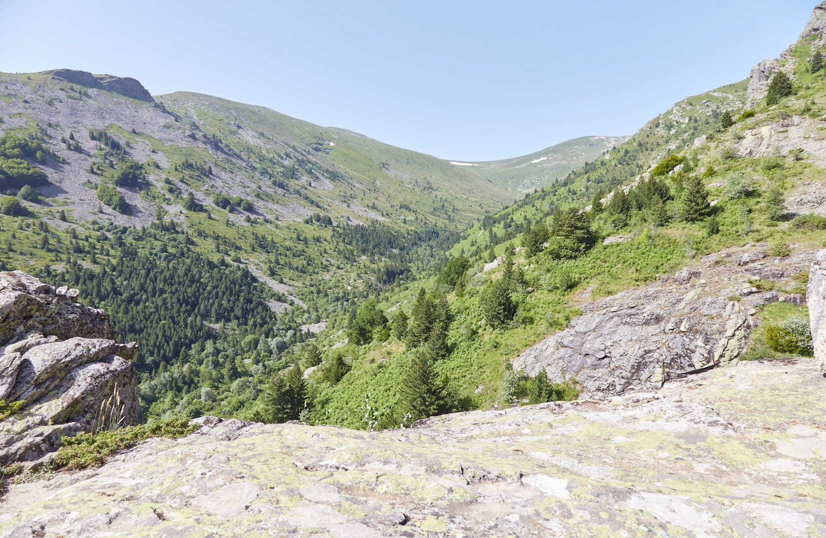
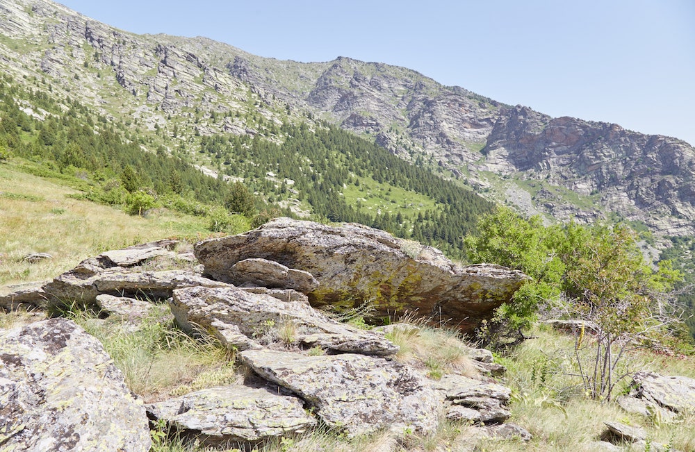
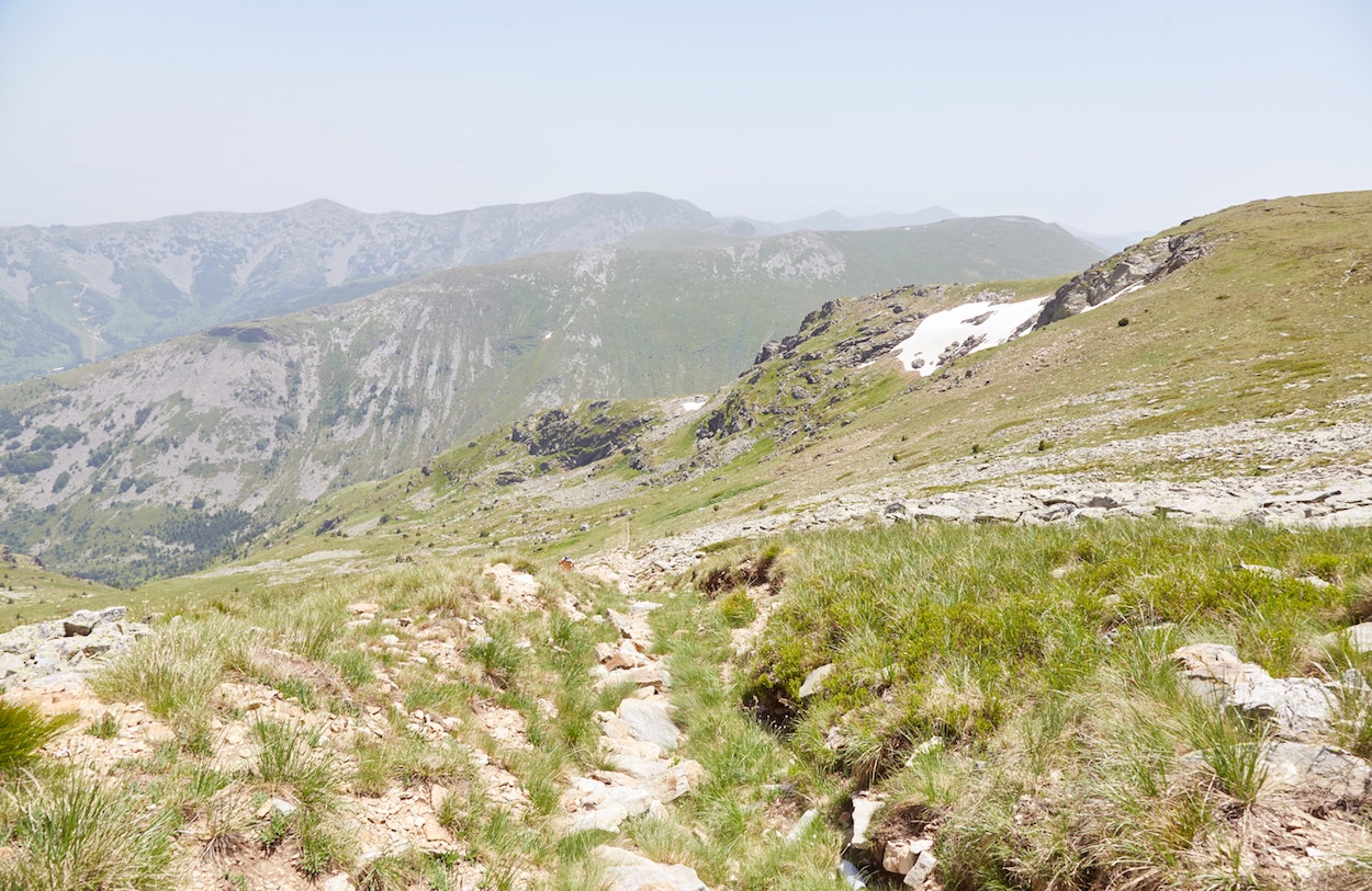
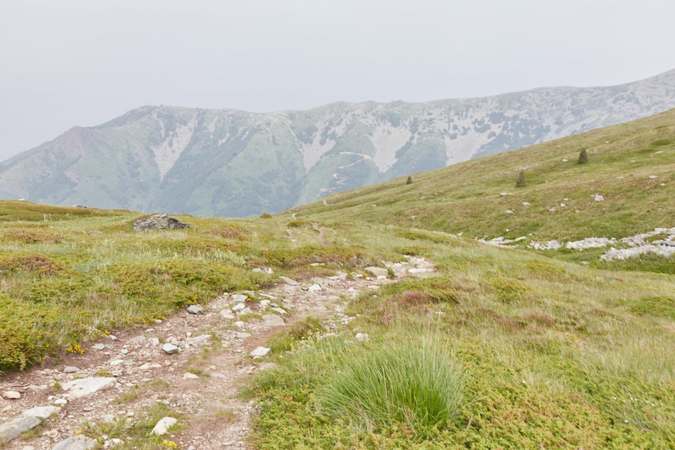
After about 70 minutes since starting the hike, we made it to the viewpoint. Standing up on a rocky outcrop, hikers can get a clear view of various valleys and peaks of the park.
For those interested in an easy hike that will only take a few hours roundtrip, the hike from Nizhepole to Vodopad and back down again won't disappoint.
In our case, however, we were only just beginning. Rather than visit the lakes first, our new plan was to hike up to the peak of Pelister, the highest point of the park. After that, we could pass the lakes on the way back down.
But while we were aware of the general direction, Pelister peak wasn't yet visible from where we were standing.
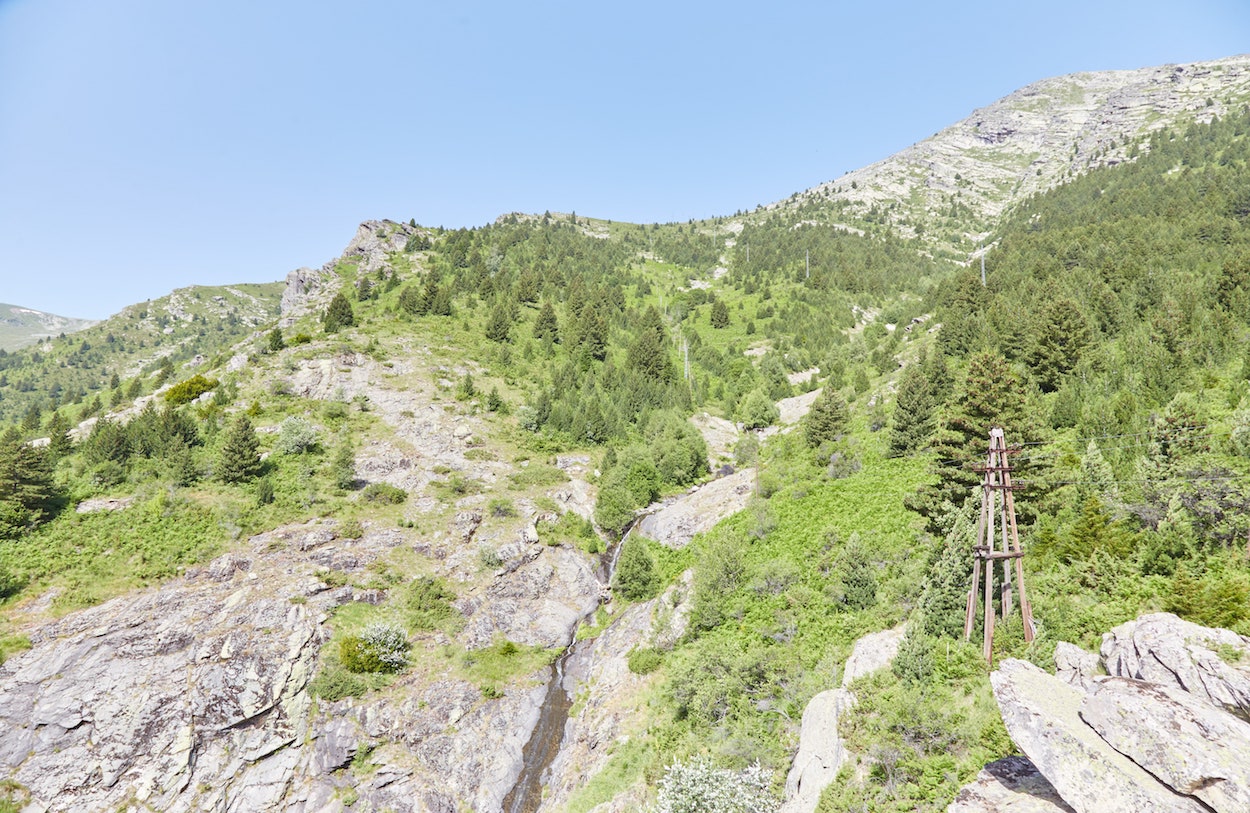
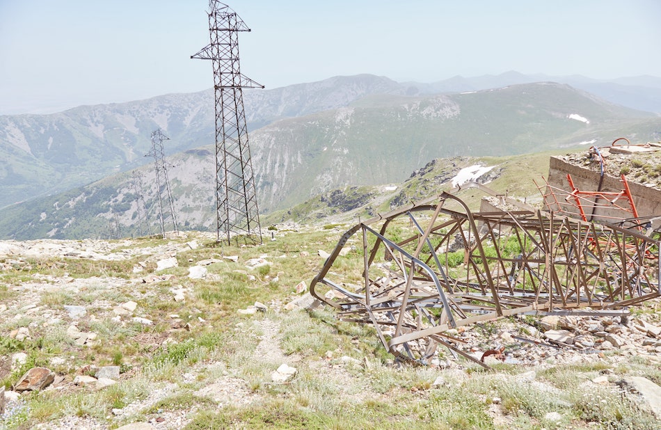
We did, however, see some transmission towers that gradually ascended up the mountain. And as Pelister peak is home to a power plant, the direction of the power lines (plus our GPS apps) revealed the direction of the peak.
We weren't going to follow the lines directly, but gradually make our way around and then up the mountain on the parts with fewer trees and overgrowth. That way, we'd at least be able to see where we were going.
Our first mission was to figure out a way over to and then across the small waterfall we spotted in the distance.
Hiking Off-Trail to Reach Pelister Peak
Making it over to the waterfall was a bit tricky, as we lost sight of it for a while due to all the trees. And our legs continued to get more and more scratched up by all the ferns and bushes, which got incredibly annoying.
But while we were no longer on an official trail, there did seem to be a very faint trail around here. It was clear that numerous people had walked this way at some point before us.
Several minutes later, we made it to the waterfall and only needed to walk over a few rocks to cross it. Our next challenge was to find the most straightforward way uphill, continuing westward toward Pelister peak.
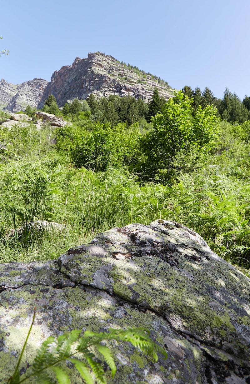
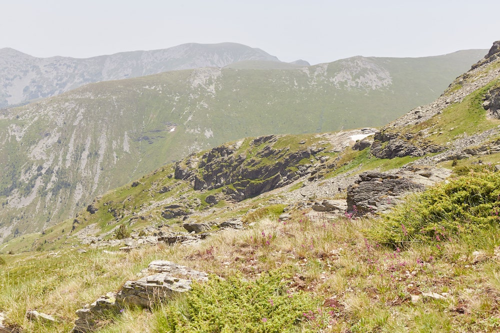
As we continued to get higher, visibility gradually improved, and the ferns became less of a nuisance. We then reached another viewpoint similar to Vodopad, but with even more impressive views.
From here we continued heading straight west in the direction of the peak (which we couldn't yet see). It was a tiring uphill climb, and we needed to stop for a few more breaks along the way.
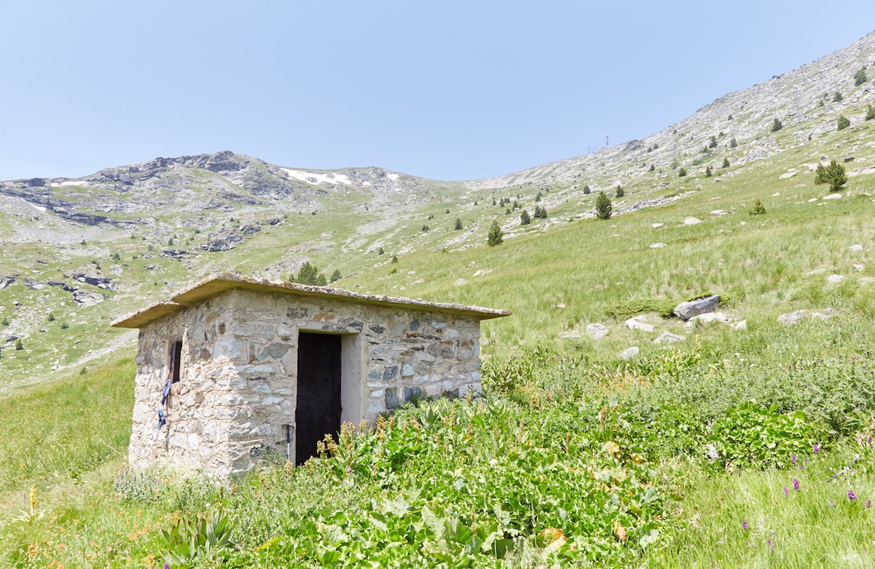
Eventually, despite being far away from any trails, we spotted a small stone cabin in the middle of a grassy field. It was empty, and there wasn't a soul in sight in the general area. But upon closer inspection, it became clear why this spot was chosen.
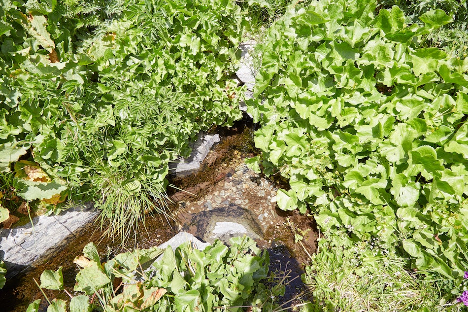
Just next to the structure was a natural spring, the discovery of which couldn't have been more of a relief. Dying of thirst, we filled up our bottles with the ice-cold water and relaxed for a while as we ate some lunch. It was already late morning by this point.
One great thing about hiking Pelister National Park is the abundance of spring water – both the natural springs like this one and the man-made taps that you'll find along the marked trails. As such, there's no need to bring a huge water bottle on your hike.
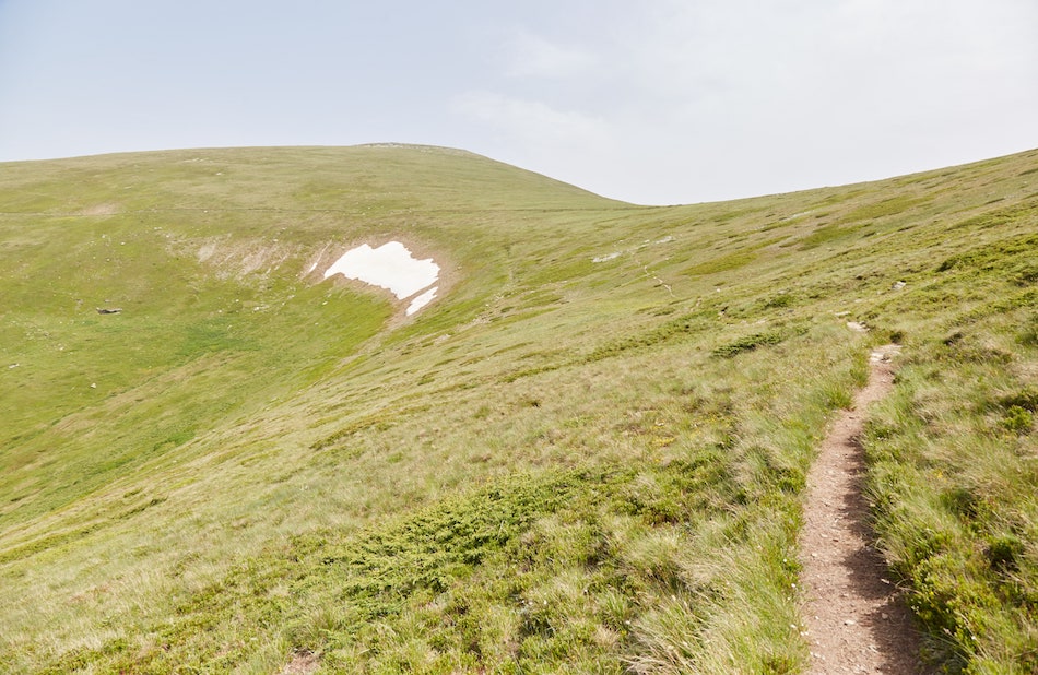
From this point, the peak of Pelister was clearly in view, recognizable by the power plant at the top. But as we'd soon learn, it appeared much, much closer than it actually was.
While the hike to the top was pretty straightforward from this point, we still had to strategize the best route, taking both the slope and the avoidance of loose rocks into account.
We climbed and climbed, repeatedly making brief stops to catch our breath. Frustratingly, the further we got, the more it became clear how far away the peak actually was. We had no choice, of course, but to keep pushing on.
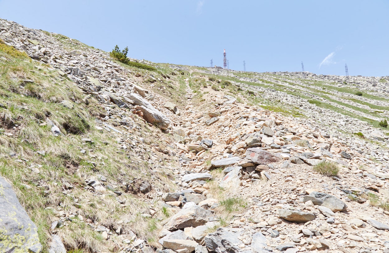
Eventually, I encountered a long and narrow indentation entirely filled with stones that lead straight to the top. The stones were covering some type of thick water pipe leading down the mountain.
While not intended as a hiking trail, it certainly came in handy. Not only did it reveal a clear path to the peak, but the stones were large and sturdy enough to act as steps.
We'd now come to the steepest part of the trek and had to keep pushing forward until the end. And after a long and steady climb, we finally made it to the very highest point of Pelister National Park. The rest of the journey would be easy work from this point on.
Frankly, arriving at the top to encounter such an unsightly power plant was a bit anticlimactic. But we felt proud of our accomplishment nonetheless.
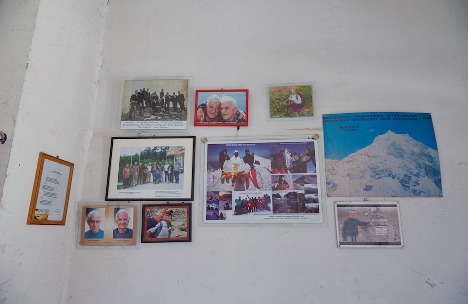
A small room in the power plant contains some photographs and general trekking information about the region, though there wasn't much else to see.
While we did see a few other trekkers (who presumably came up the proper trail), there's no snack kiosk whatsoever, nor even a bathroom. As such, it's imperative that you bring enough food to last you the day.
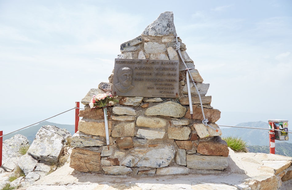
Before heading onto the lakes, we walked over to a small memorial for a man who'd died in the park back in 1989, though it's unclear how. While somber, the area offers some amazing views. From some angles, you can even see part of Lake Prespa.
Hiking to the Pelister eyes
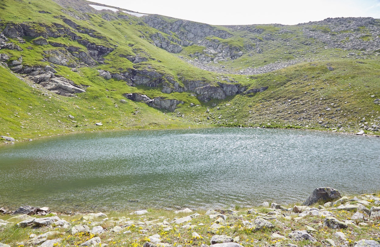
As mentioned earlier, Pelister National Park is home to two lakes known as the Pelister Eyes. They're the park's most-visited landmarks, as it's possible to see them without making the grueling hike up to Pelister peak.
In our case, the hardest part was already over, so we could stop at the lakes on the way back to Nizhepole. From the peak, the small lake, or 'Malo Ezero' is about one hour away while the larger lake, 'Golemo Ezero,' is another hour beyond that. Past the second lake, it then takes another hour and 45 minutes or so to reach the village.
As exciting as the ascent was, we were relieved to be back on a clearly marked trail. Especially one that was void of scratchy plants.
On the way down, we even passed a big pile of unmelted snow - a strange sight to see (and touch) during the peak of summer.
While the trail here is well-marked and pretty straightforward, there are a few points where it forks into two.
For those who happen to be hiking from the peak to the lakes, after ten or fifteen minutes into the journey, you'll encounter a trail that will take you down into a valley. But this is not the path you want to take. You'll want to take the lefthand trail to keep heading south.
After an hour or so of walking, the small lake will only appear once you're right in front of it. It's a beautiful oval-shaped lake, and it ended up being the one I liked best. It was the perfect place to sit down for even more snacks.
And then it was time to head onward to the bigger lake. As you make your way eastward, you'll need to pay attention once you arrive at the dirt road meant for 4x4's.
You don't want to follow the road for very long, but to cross diagonally onto the hill until you reach the other side.
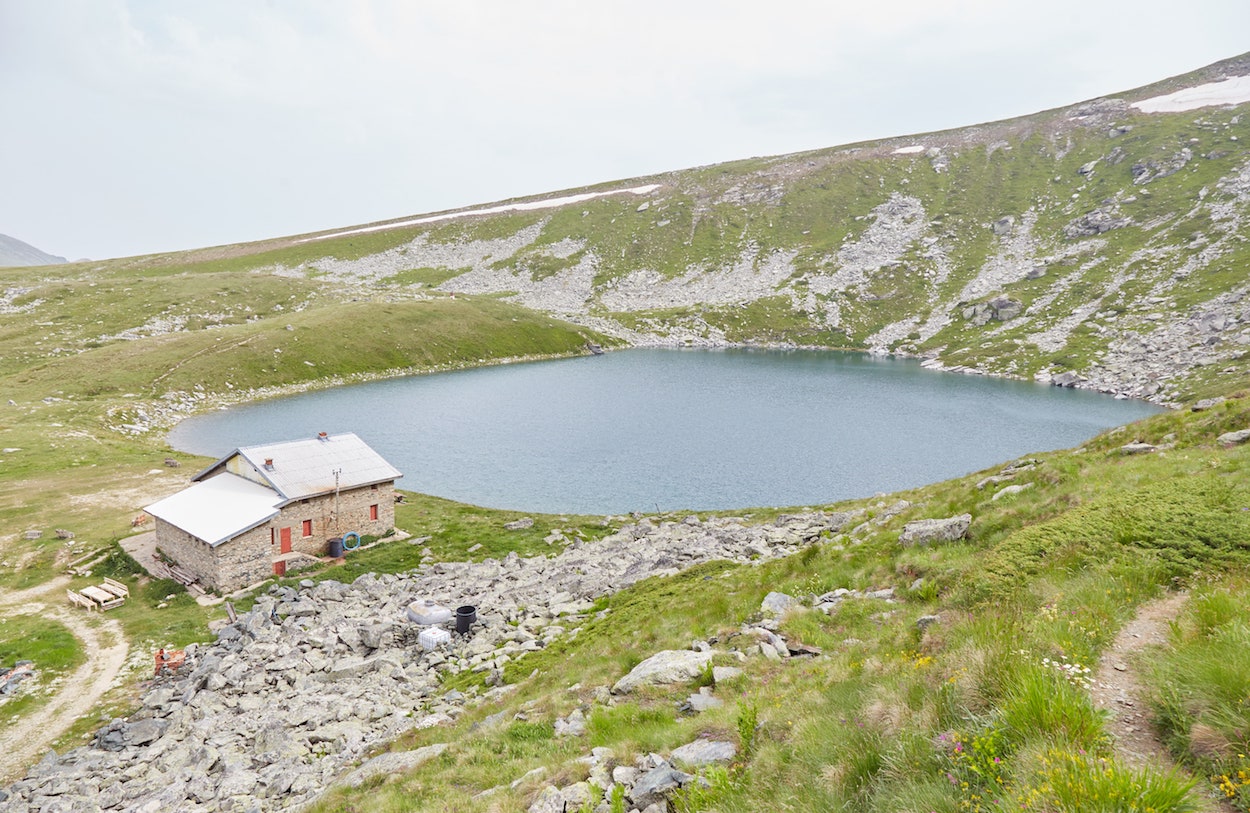
The bigger lake will eventually appear in the distance, but finding the correct trail down can be a little bit tricky. Pay close attention and you should eventually figure it out.
As you'll notice, there's a large cabin beside the lake. But if you're there on a weekday, don't expect to find anyone inside. While it operates as a guesthouse for trekkers, it's only open on the weekends, probably due to low demand. Sadly, hiking Pelister National Park is just not as popular as it ought to be.
While I enjoyed the lake, I was feeling pretty eager by this point to make it back to Nizhepole, and then Bitola. I was tempted by the though of a nice warm shower at the hotel.
As mentioned, the hike down to Nizhepole from this point lasts about an hour and 45 minutes. Fortunately, it wasn't too steep, but I was still glad to have my trekking poles to ease the pressure on my knees.
The descending hike was pretty straightforward and relatively uneventful. We did, however, pass by multiple springs which were always a welcome sight.
We'd gotten lucky that day thanks to clouds forming overhead at what was supposed to be the hottest part of the day. But it was still humid and important to stay hydrated.
Reaching the bottom, you'll find some signs pointing you in the direction of Nizhepole. You'll likely want to double-check on your phone, however, as the path can veer off into multiple directions near the village.
Finally back in Nizhepole, we had to figure out how to call a taxi back to the village. Our plan was to walk into the nearest hotel, about ten minutes away, and ask them to call one for us. (Not only did we not speak Macedonian, but we had no idea which number to call).
But along the way, we walked past a man who was picking cherries on his property. He spoke a few words of English and we explained the situation. He kindly called a taxi for us and, as we waited, he even gave us a big bag of cherries to snack on! It was a sweet end to a long and grueling hike.
You can take both direct buses and trains from Skopje and Prilep, where there are also numerous daily buses from nearby Ohrid.
Despite being North Macedonia's second-largest city, however, getting to Bitola was trickier than I expected. Much of the difficulty comes from the fact that there's no reliable source for bus schedules online.
I arrived at the bus station in Ohrid a little after 9:00. As Bitola is only about an hour away, I expected there to be buses leaving every hour. But I was told there was a reduced schedule due to the coronavirus pandemic, and the next bus wouldn't leave until 12:30! (This was at a time when the number of daily new cases was only around a dozen.)
Thinking I had no choice, I bought a ticket for a couple hundred MKD and waited. After an hour or two, I decided to take a walk outside to look for something to eat. I passed a shared taxi, and a woman asked me if I was going to Bitola. She explained that the taxi cost the same price as the bus.
I told her I didn't realize that, but I'd already bought my bus ticket. The taxi needed one more passenger for it to depart, so she insisted that she'd cover my fare if I joined them.
And so I ended up taking the shared taxi to Bitola, as the kind and helpful woman explained how common and cheap they are throughout North Macedonia. If you're coming from Ohrid, this is the method I recommend.
Later leaving Bitola for Prilep, however, there were no shared taxis headed there (they exist, but you must head to another part of town). And I faced a similar dilemma with the buses only leaving every few hours.
Fortunately, I was able to take a train which departed at 12:50 in the afternoon, and made it to Prilep without any issue. At around 100 MKD, the train was even cheaper than the bus.
I stayed at Domestika Hostel, which was one of my top stays in North Macedonia and the Balkans in general. The hostel is situated about five minutes from the bus and train station, and right across from a large park. It's also within easy walking distance of Heraclea Lyncestis.
For about €10 a night, I stayed in a spacious private room with a private bathroom. It also had air conditioning.
The staff were incredibly kind and helpful, and the place has a nice little garden area where you can relax and chat with other travelers. For budget travelers, I couldn't recommend Domestika Hostel highly enough.
All in all, Bitola is a small and very walkable city. As long as you're staying somewhere relatively central, you should be able to get to all the major landmarks on foot.
Regardless of where you're staying, those wishing to hike in Pelister National Park can easily take a taxi to the village of Nizhepole for around 250 MKD.


No comments:
Post a Comment